Count locations mark the geographic position of traffic counts. This can be both one-off counts and permanently installed counting features. A count location is identified by a number. Apart from a code and a name, it always has a position on a link, described by the ID of the link (From Node and To Node) as well as a relative position. This is a number between 0.0 and 1.0 and describes where the count location lies on the link. Since a link in Visum is always directed, a direction is indicated as well. Furthermore, the count location has a type, to differentiate permanent count locations and manual count locations, for example. The coordinates of the count location are available as a calculated attribute; these are calculated from the coordinates of the link and the position along this link. Each link can be assigned by direction to one or more count locations. Each count location can in turn be assigned to detectors.
The detector is identified by its number and in addition to code and name it has a geographic position, specified by a pair of coordinates. Two types of detectors are distinguished:
- The detector is allocated to a node or a main node. This type of detector serves to model signalization, for example, traffic-responsive signal controls. It is not possible to define a reference to count locations.
- The detector is defined freely in the network and as an option, it can be allocated to a count location, and so also indirectly to a link. In this case the detector constitutes a lane-based count location. It breaks down the count data of a count location precisely by lane. The number of observed lanes is defined via the observed lanes attribute. The lane observed on the far right is defined via the Lane position attribute. If a detector is allocated to a count location and therefore, to a link, the observed lanes have to be compatible with the number of link lanes. This means that no lane which is not defined on the link may be observed. With a lane number of two the detectors for lanes 1 and 2 are allowed to be defined. It is however permitted, that a lane is observed by several or no detectors.
Count locations and their detectors are used less to maintain data, but more to visualize and process thematic maps. Even though you can save count data to user-defined attributes of count locations, you can also save them directly to user-defined attributes of the link (User-defined attributes). The advantage of saving count data directly at links is that, in evaluations, you can compare them directly with the calculated volumes, which are also saved with the link attributes. This approach is particularly recommended if you want to use the matrix correction technique TFlowFuzzy (Updating demand matrices – general information).
Count locations are thus primarily used for marking the position of a count in the network. You can use the number to refer to external data, where applicable. The Image 28 shows a map, which is illustrated in the local position of the count location in the network, together with the date of the last traffic count.
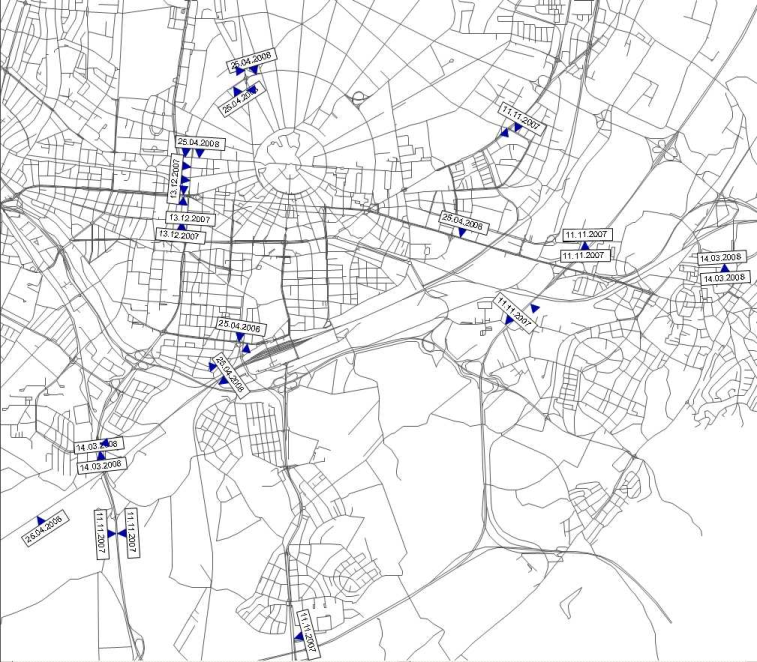
Image 28: Visualization of the local position of count locations with the date of the count
|
Notes: Do not just use count locations to integrate count values into the network. Instead use user-defined attributes on links. However, if the current project requires the visualization of counts or count location-related values shall be managed externally, the effort for the coverage of count locations and detectors can pay off. Compared to assignments for example, count locations and detectors do not have an influence on procedures. The only exception are detectors near nodes which can be taken into account for traffic-responsive signal control. Information provided by these detectors are also used for ANM export to Vissim. |
