The air quality layer displays a "heat-map" associated to the distribution and concentration of pollutants.
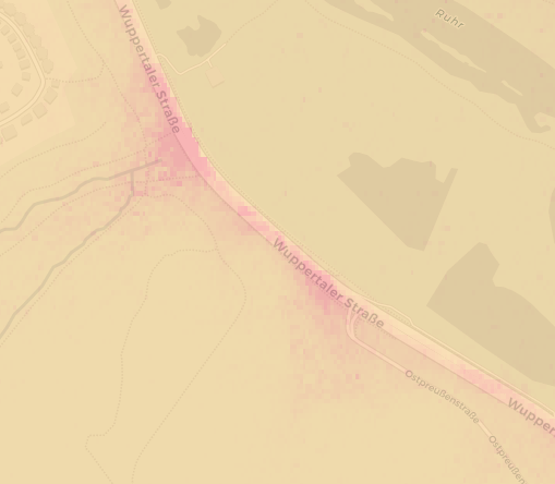
The example shows the pollutant intensity of CO along Wuppertal Road:
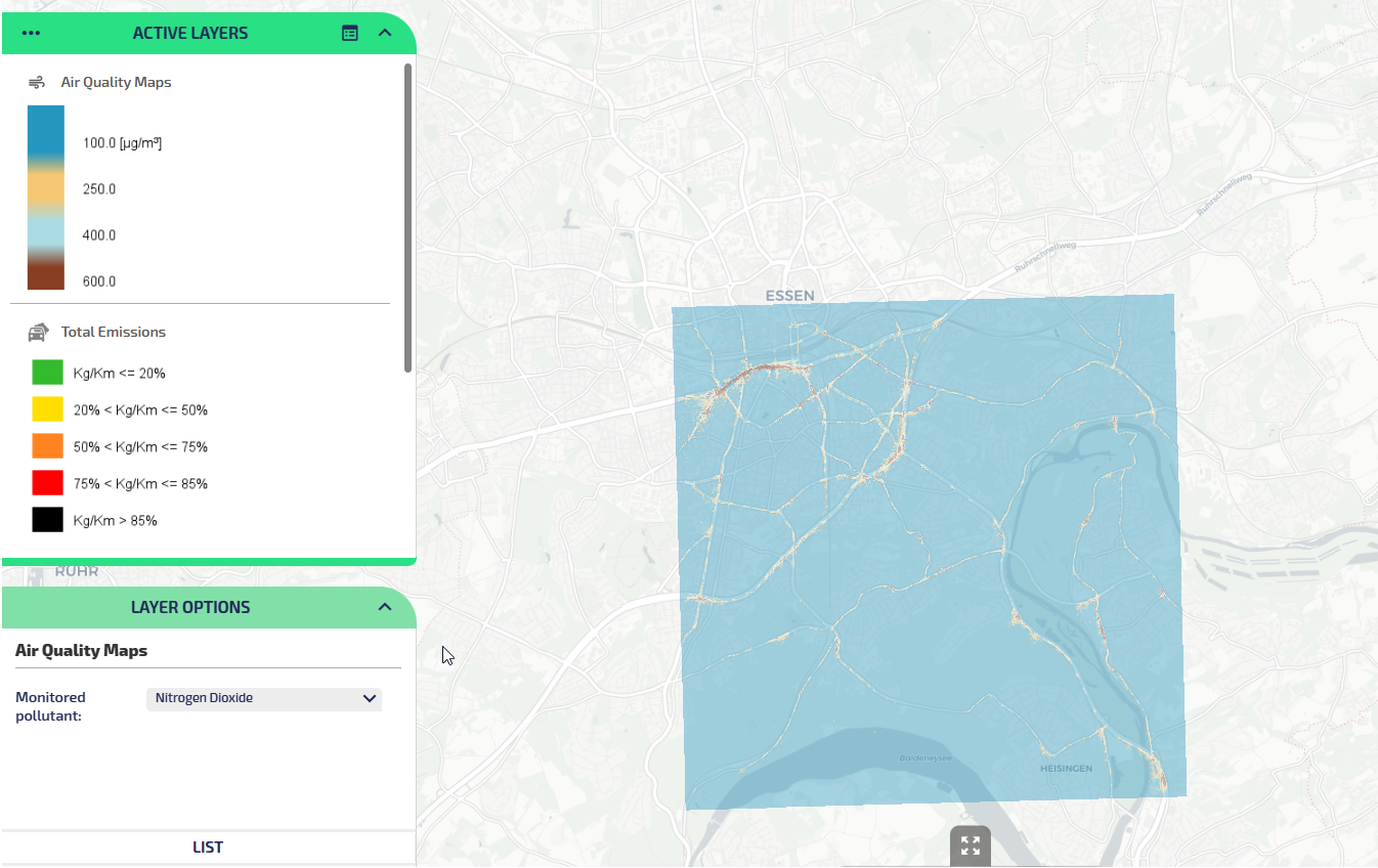
The second example highlights the pollutant intensity of NO2 in a large area:

The pollutants that you may display are:
-
Carbon Monoxide
-
Nitrogen Dioxide
-
Sulfur Dioxide
-
PM 2.5
-
PM 10
-
Ozone
You can configure one to ten distinct thresholds to be associated to pollutants and, according your defined thresholds, a scale of colors shows the concentration of each respective pollutant.
Important: You can customize the set of traceable pollutants and the associated thresholds values for any specific pollutant (→ Layers configuration > AirQualityMaps).
The layer legend will be updated each time a new pollutant is selected when using the Monitored pollutant layer option.
In this example, you can see a gradation of three colors being displayed for three thresholds respectively:
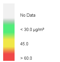
The gray scale is shown in absence of data.
Here, the green scale is associated to the first threshold, the yellow scale to the second threshold, and the red scale is associated to the third and last threshold.
In the following example, you can see a gradation of four colors (blue, beige, light blue, brown) being displayed about four thresholds respectively:
Important: You can set a different set of thresholds and gradation of colors for any distinct pollutant.
Any pollutant of the aforementioned list is associated to a display name that you can select in the Monitored pollutant combo-box (LAYER OPTIONS area):

| Option type | Description |
|---|---|
| Theme | It allows you to choose a set of graphic themes to represent the layer entities. |
| Monitored pollutant |
It allows you to choose the pollutant you want to track on your map:
|
- Select the layer on the ACTIVE LAYERS list.
- Click the
 List icon.
A pop-up window with a list of items opens. Every item represents a Bosch sensor, which is characterized by a set of attributes.
Other operations are available for the layer (→ Operations on layers).