You can create a map section of OpenStreetMap data for quicker and more effective data import.
How to import a small section of an OpenStreetMap data record:
1. Start Visum with an empty user interface (Starting with an empty program interface)
2. Then show a dynamic background map (Dynamically embedding background maps provided on the Internet ).
3. Zoom into the map, so that the map section for which you want to import OpenStreetMap data is visible.
4. From the File menu, choose > Import. Then select OpenStreetMap.
The OpenStreetMap Importer window opens.
5. Make the desired changes (Running the import process with a predefined configuration)
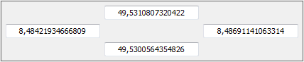
6. Select the Clip network to bounding box option.
In the section next to the option, the current WGS84 coordinates of the selected network section are listed.
Example
|
Note: If required, you can edit the coordinates manually. |
7. Make the other settings for importing the network section.
| Element | Description |
|---|---|
|
Importing OSM elements that lie entirely outside the section |
Select this option to import elements that lie entirely within the selected section. For instance, nodes lying outside the section or links lying partly outside the section will not be imported. |
| Importing OSM elements that lie entirely or partially outside the section |
Select this option to also import elements that only partly lie within the selected section. For instance, links lying partly outside the section are fully imported. |
8. Confirm with OK.
The network of the OpenStreetMap section selected is imported.
