A Point of Interest (POI) is a user-defined network object with spatial reference. The spatial reference is established by entering an X and a Y coordinate for each POI. POIs can be inserted as point or surface objects. Each POI can be assigned a surface (attribute Surface ID) as an option or any image (attribute Image file name). By default, Visum already offers a preselection of symbols, which can be used for visualizing POIs (star, cross, triangle, signal controller, and others).
|
Note: POI polygons are managed like surfaces and can be made up of multi-face polygons or polygons with "holes" (The surface data model in Visum). |
Points of interest are mainly used for data management (for example, network data maintenance in Traffic management centers) and accessibility studies. For your data management, you can create as many user-defined attributes for POIs as you like, in which you can store your data (User-defined attributes). The Image 26 shows an example for applying POIs in reachability analyses. Here secondary schools are included as POIs (red stars) in the model. The catchment area of these schools was visualized with the 2D display (2D display).
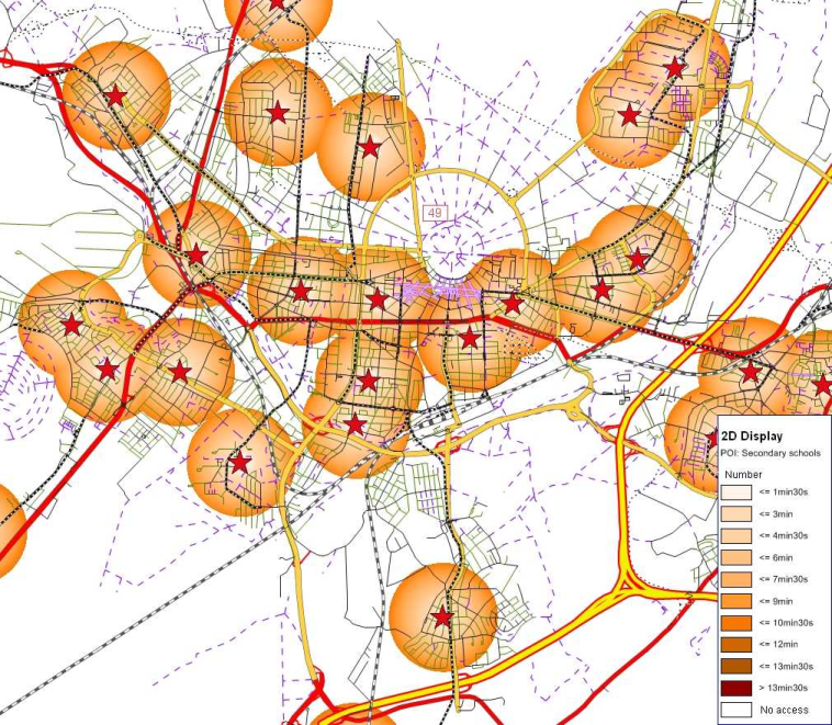
Image 26: Reachability analyses for secondary schools
POIs are managed in POI categories. Each POI must be allocated to a POI category. Before inserting the first POI, you thus have to create a POI category (User Manual: Creating a POI category). Any number of POI objects can then be inserted in the defined POI category, in the network.
POI categories in a transport network are for example
- Parking and Park&Ride facilities
- Public facilities such as schools, churches of hospitals
- Pre-emption points for AVLS (automatic vehicle location systems)
- Signal controllers etc.
POI categories can be organized as a hierarchy. This is how you can create a POI category schools with the three subcategories secondary schools, junior high schools and elementary schools.
Each POI can be assigned to a node, a link, another POI, a stop area, a stop point or a POI category. You can illustrate this assignment graphically in the network (User Manual: Displaying Points of Interest). In the example of Image 27 allocations are used to illustrate for parking lots in a downtown area which links the approaches lead to.
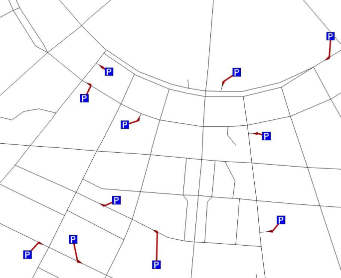
Image 27: Allocating POIs to links
If you want to import data from GIS systems into Visum, these data can be stored as POIs in the network model (User Manual: The Shapefiles interface).
|
Notes: POIs and their assignment to network objects do not have an influence on procedures, such as assignments for example. If you create a user-defined attribute for a POI category, it will also be created for all subcategories of the POI category. |
