When importing surfaces from different sources, incorrect overlaps and gaps may occur between the surfaces.
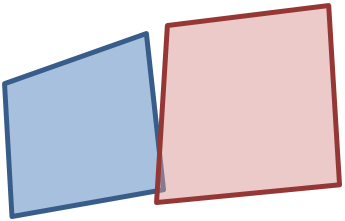
Image 45: Surfaces after import
You can compensate for these deviations by performing a fuzzy alignment of the surfaces. The points of the surfaces are shifted within a defined tolerance in this case. The adjustment is possible for the following polygon objects:
- Zones, Main zones
- Main nodes
- Territories
- polygonal Points of Interest (POI)
- Restricted traffic areas
You can call the function at various points in the program:
- From the menu, choose Edit > Surfaces (User Manual: Fuzzy alignment of surfaces)
- During Shapefile import (User Manual: Importing Shapefiles)
The procedure is as follows:
1. Define reference surfaces in the existing network
2. Define number of surfaces to be imported
3. Define tolerance values for fuzzy alignment
The definition of the tolerance values determines the result of the fuzzy alignment.
If tolerance values >0 are specified for existing surfaces and imported surfaces, the surfaces are adjusted to each other.
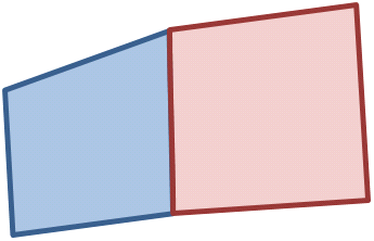
Image 46: Blue and red surfaces were adjusted to each other
If you define a surface as a reference surface by setting its tolerance value to 0, the second surface adjusts itself to the reference surface.
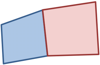
Image 47: Blue surface is the reference surface, red surface adjusts itself to the blue surface
