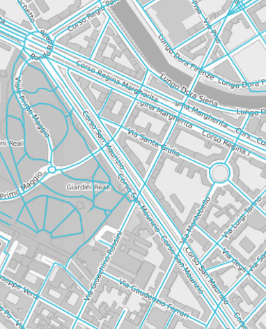
The Streets layer displays the road network.
Click a street to obtain detailed information and charts about traffic conditions.
Tip: You can get the same result through the operation (→ Showing a selected item).
| Info type | Description |
|---|---|
|
The color of the street indicates whether a street can be used (or not) by cars. |
| Option type | Description |
|---|---|
| Theme | It allows you to choose one of a set of graphic themes to represent the layer entities. |
- Click on a street to select it.
-
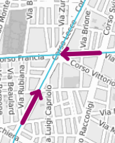
Click the left side area (or the right side area) of the link to view the graphic indication of the direction of the traffic flow.
A purple bold arrow appears.
- Select the street to open the pop-up window displaying the list of related attributes.
The window includes different buttons to produce different types of charts:
| Chart button | Description |
|---|---|
| Flow |
It displays the traffic flow dimension. |
| Travel time | It displays the travel time needed to complete a link or a street of the traffic network. |
| Speed |
It displays the vehicle speed along a specific link or street of the traffic network. |
| Queue | It displays information about vehicle queues. |
- Select the layer in the ACTIVE LAYERS list.
- Click the
 List icon.
A pop-up window with a list of items opens. Every item represents a street which is characterized by a set of attributes.
Other operations are available for the layer (→ Operations on layers).